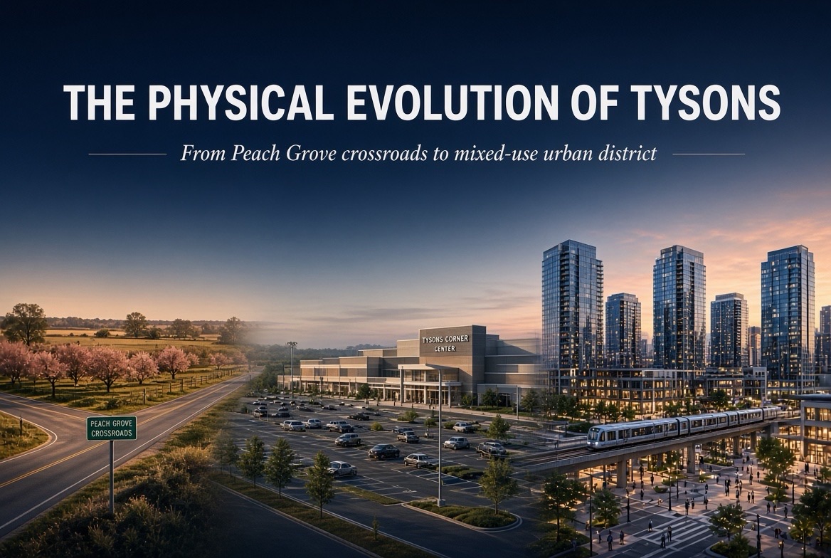
From Peach Grove crossroads to mixed-use urban district
Thesis: Tysons did not simply grow; it was repeatedly re-engineered. Each phase converted access advantages into a different physical form: rural road junction, enclosed regional mall, two-mall retail district, office edge city, and finally a station-linked mixed-use center.
Executive Overview
This report follows the physical transformation of Tysons, Virginia, with Tysons Corner Center as the organizing artifact. The central claim is that Tysons became powerful not because a single mall was successful, but because the district continually rebuilt itself around changing access, retail economics, land values, and planning policy.
Early Tysons was a lightly developed rural crossroads. The 1968 mall converted highway proximity into a climate-controlled, department-store-anchored shopping machine. The 1980s expansion doubled down on regional retail dominance and upscale positioning, while Tysons Galleria and nearby office development turned the crossroads into a two-mall commercial district.
From the 1990s through the 2000s, the surrounding landscape filled with office buildings, hotels, structured parking, and corporate campuses, producing the classic Washington-area edge city. In the 2010s, the Silver Line and Fairfax County planning policy changed the development logic again: Tysons was no longer expected to function only as an auto-oriented shopping and employment node, but as a denser, walkable, mixed-use urban center.
1. Introduction — From Crossroads to Urban Center
Tysons is best understood as a sequence of physical business models. Its first model was geographic: a road junction that mattered because Chain Bridge Road and Leesburg Pike connected farms, villages, and later the Washington region.
Its second model was suburban retail: a large enclosed mall ringed by surface parking, designed for households arriving by automobile. Its third model was competitive regional luxury: Bloomingdale’s, Nordstrom, Lord & Taylor, and the Galleria repositioned Tysons from a convenient county shopping center into a destination for a metropolitan trade area.
Its fourth model was the office edge city: towers, hotels, and headquarters clustered around roads rather than a traditional downtown street grid.
Its current model is urban retrofit: Fairfax County planning and Metrorail access aim to convert isolated superblocks and parking fields into a live-work-shop district with streets, plazas, residential towers, and transit walksheds.
County planning materials describe a long-range Tysons vision of up to 100,000 residents and 200,000 jobs by 2050, with three-quarters of new development within a half-mile walk of Metrorail stations. A 2024 Fairfax County Economic Development Authority profile describes Tysons as the largest business district in Fairfax County, with 35.6 million square feet of office space and 149,095 total jobs, and emphasizes four Silver Line stations and rail access to Washington Dulles International Airport.
Those numbers matter physically: they explain why the district’s design problem shifted from attracting drivers to managing density, walking, transit, and redevelopment.
2. Before the Mall: Peach Grove, William Tyson, and the Rural Road Landscape
Before it became a retail and office district, Tysons was part of a rural Fairfax County landscape commonly associated with Peach Grove and the Tyson family. The place-name Tysons Corner grew from a crossroads identity rather than from a town plan: roads, farms, small commercial uses, and scattered residences gave the area its structure.
The intersection that became Route 7/Leesburg Pike and Route 123/Chain Bridge Road was the essential physical fact. In the pre-mall landscape, buildings were separated by fields and woodland; visibility came from the road, not from a skyline; and land value depended on agricultural production and local movement rather than regional retail capture.
The best visual evidence for this phase is not a storefront photograph but an aerial sequence: 1930s–1960s imagery can show fields, tree lines, road geometry, and the absence of large parking fields. Historic Fairfax County GIS aerials are therefore a key source for establishing the “before” condition.
3. 1968 — The Birth of Tysons Corner Center
Tysons Corner Center opened on July 25, 1968, as a large enclosed super-regional shopping center whose physical form embodied the postwar automobile economy. Its original anchor department stores were Hecht’s, Woodward & Lothrop, and Lansburgh’s.
The site plan placed the mall within a vast parking field, making the building less a street address than a destination reached by regional roads. The mall’s relationship to Route 7 and Route 123 was strategic: the architecture faced the automobile first, with multiple parking-field entrances feeding a controlled interior retail environment.
Inside, the original design used named courts — Umbrella Court, Fashion Court, Fountain Court, Aviary Court, and Clock Court — to break a long retail concourse into recognizable social and navigational spaces.
These courts mattered architecturally because enclosed malls had to simulate a public realm without being a street. Skylights, fountains, indoor landscaping, lighting, signage, and department-store portals turned the mall into a weather-proof promenade.
The physical strategy was clear: put the car outside, the shopper inside, and the department-store anchors at the ends and nodes of circulation so specialty tenants benefited from foot traffic between them.
4. 1970s–1980s — Expansion, Upscaling, and the Birth of Tysons I
The 1970s tested the original department-store mix. Lansburgh’s closed in 1973; the space passed through Lit Brothers before Bloomingdale’s opened in 1976.
Bloomingdale’s was significant not simply as a tenant change, but as a repositioning of Tysons’ physical and commercial identity. A fashion-oriented, full-line Bloomingdale’s made the mall feel less like a county shopping center and more like a regional retail destination.
That change anticipated the much larger 1980s transformation. The approximately $150 million-plus expansion and redevelopment of the late 1980s added a second level, new atriums, skylights, escalators, marble and brass finishes, expanded corridors, and major new anchor strategies.
Nordstrom’s arrival was nationally significant for the company because Tysons became its first full-line location east of the Mississippi; Lord & Taylor followed in 1990.
The expansion was not a cosmetic renovation. It reworked the mall’s volume, vertical circulation, tenant economics, and image. The second level increased rentable area without requiring a proportional new land footprint, while higher-end materials and new anchor stores responded to regional affluence and competition.
In physical terms, Tysons Corner Center moved from a one-level suburban mall to a denser, multi-level retail machine.
5. 1988 — Tysons Galleria and the Making of Tysons II
Tysons Galleria, originally the Galleria at Tysons II, opened in 1988 across Route 123 with an explicitly upscale position anchored by Macy’s, Neiman Marcus, and Saks Fifth Avenue.
Its arrival changed Tysons from a single dominant shopping center into a two-mall district. The distinction between “Tysons I” and “Tysons II” was more than branding.
Tysons Corner Center represented the older, broader super-regional mall that had expanded upward and upscale. The Galleria represented purpose-built luxury retail embedded in a larger office and hotel environment.
Together with the Corporate Office Centre at Tysons II, the Galleria helped shift the district’s visual center of gravity: the landscape no longer consisted primarily of a mall surrounded by parking, but of retail, office buildings, structured parking, and arterial roads forming a new commercial cluster.
6. 1990s–2000s — The Rise of the Edge City
By the 1990s and 2000s, Tysons had outgrown the idea of a shopping crossroads. Office towers, hotels, corporate headquarters, and internal district roads such as International Drive and Jones Branch Drive turned the area into an edge city: a suburban concentration of jobs, retail, and corporate identity with no historic downtown core.
Major corporate and office nodes, including Capital One, Gannett/USA Today, MicroStrategy, Towers Crescent, and other office developments, reinforced the pattern.
The built environment was dense by suburban standards but often difficult on foot: wide arterials, superblocks, structured parking, surface lots, and isolated building pads produced a high-value but auto-dependent district.
The economic logic was agglomeration — professional services, finance, technology, media, government contracting, retail, and hospitality — but the physical logic remained fragmented: roads connected parcels better than sidewalks connected places.
7. 2000s–2010s — Rebuilding Tysons Corner Center for Experience and Mixed Use
The Macerich-era redevelopment of Tysons Corner Center in the 2000s reflected a broader shift in mall economics. Department stores were no longer enough to carry the entire property strategy.
Redevelopment around the former JCPenney area introduced entertainment, bookstore, restaurant, and lifestyle uses, including AMC, Barnes & Noble, new restaurants, and new public-facing circulation.
This was a physical response to changing consumer behavior: shoppers increasingly expected dining, entertainment, and social space, not just anchor-to-anchor retail.
In the 2010s, the property’s mixed-use phase pushed the shift further. Office, residential, hotel, retail, and plaza components were planned and built around a new outdoor public realm.
The Tysons Corner Center Plaza, residential tower, office tower, hotel, new entrances, landscaping, and pedestrian connections attempted to attach urban life to a mall that had originally been separated from its surroundings by parking fields.
The design philosophy changed from “arrive, park, shop, leave” to “live, work, stay, meet, shop, and transfer.”
8. Silver Line and the Urbanization of Tysons
The Silver Line was the transportation event that made the urban retrofit credible. Phase 1 opened in 2014 and placed the Tysons Corner station directly adjacent to Tysons Corner Center.
The station and pedestrian bridge changed the hierarchy of access: for the first time, the mall had a major front door not defined by a parking lot.
Fairfax County’s planning framework tied future growth to Metrorail walksheds, explicitly connecting density to transit access.
Physically, the Silver Line introduced elevated guideways, station structures, pedestrian bridges, and a new reason to build streets and plazas rather than only drive aisles and parking decks.
It did not erase auto dependence, but it created a second organizing system. Before Metro, Tysons was a set of destinations connected mostly by roads; after Metro, the district could be planned as station areas connected by sidewalks, trails, shuttles, and redevelopment parcels.
9. Tysons Today and Tomorrow
Today, Tysons Corner Center remains one of the largest retail centers in the United States and a major anchor of the district, but it is no longer only a mall.
Its contemporary physical configuration includes enclosed retail, multiple anchor and junior-anchor spaces, entertainment, restaurants, structured and surface parking, direct Metro access, an outdoor plaza, office, hotel, and residential components.
Tysons Galleria remains the luxury counterpart across Route 123, while the surrounding district contains the office, hotel, and residential density that now defines Tysons as an employment center.
Little of the original 1968 shopping environment remains legible to a casual visitor. Some underlying structural alignments, site boundaries, and portions of earlier anchor infrastructure may persist, but the customer-facing architecture has been repeatedly remade through anchor changes, vertical expansion, finishes, circulation, and mixed-use additions.
Future redevelopment should be described carefully. Completed projects include the Silver Line, major Tysons Corner Center mixed-use Phase I, and multiple office/residential developments. Planned or conceptual projects include further redevelopment of former department-store sites, additional residential and office density, new public spaces, street-grid improvements, and pedestrian infrastructure under Fairfax County’s Tysons planning framework.
10. Conclusion — What Changed and Why
Tysons changed physically because each generation of owners, retailers, planners, and transportation agencies solved a different problem.
- The rural crossroads solved movement through a farm landscape.
- The 1968 mall solved regional shopping access in an automobile suburb.
- The 1970s and 1980s transformations solved competition and affluence by expanding upward and adding stronger fashion anchors.
- Tysons Galleria solved the luxury-positioning problem and created a two-mall district.
- The office boom solved demand for suburban corporate space near highways and airports, but produced congestion and fragmented urban form.
- The 2000s lifestyle redevelopment responded to the weakening department-store model by adding entertainment, dining, and public-facing activity.
- The Silver Line and mixed-use planning addressed the long-term land-use problem: Tysons could not continue growing solely as an auto-oriented collection of superblocks.
The result is a place where architecture, economics, transportation, land use, and retail strategy are inseparable. Tysons became urban not by abandoning the mall, but by repeatedly rebuilding around it.
Tysons I vs. Tysons II — Comparative Physical Strategy
| Category | Tysons Corner Center / Tysons I | Tysons Galleria / Tysons II |
|---|---|---|
| Opening | 1968; major late-1980s expansion | 1988 |
| Original role | Broad super-regional enclosed mall for the Beltway-era suburb | Upscale companion mall and luxury retail statement |
| Architectural character | Large enclosed concourse, themed courts, surface parking, later second level and atriums | More refined luxury interior tied to office/hotel district |
| Retail positioning | Middle-to-upscale regional retail; later strengthened by Bloomingdale’s, Nordstrom, and Lord & Taylor | Luxury and fashion-oriented; Neiman Marcus/Saks positioning |
| Levels | Originally one major retail level; later expanded vertically | Multi-level enclosed luxury mall |
| Site design | Large auto-oriented parcel; parking fields/decks; later plaza and Metro connection | Across Route 123; integrated with Tysons II office/hotel environment |
| Target consumer | Mass regional trade area, later broadened upward | Affluent regional and destination shopper |
Major Development Timeline
| Date | Milestone |
|---|---|
| Pre-1960s | Peach Grove/Tysons rural crossroads landscape; roads, farms, scattered buildings, and the Route 7/Route 123 junction form the physical basis for later development. |
| 1962 | Washington Dulles International Airport opens, strengthening Northern Virginia’s regional access logic. |
| 1964 | Capital Beltway completed/opened in phases, dramatically increasing circumferential automobile access around Washington. |
| July 25, 1968 | Tysons Corner Center opens with Hecht’s, Woodward & Lothrop, and Lansburgh’s. |
| 1973 | Lansburgh’s closes. |
| 1976 | Bloomingdale’s opens in the former Lansburgh/Lit Brothers space. |
| 1984 | Dulles Toll Road opens, improving east-west regional access. |
| 1988 | Major Tysons Corner Center expansion adds vertical density, new finishes, circulation, and Nordstrom. |
| 1988 | Galleria at Tysons II opens with luxury positioning. |
| 1990 | Lord & Taylor opens at Tysons Corner Center. |
| 1997 | Tysons Galleria renovation refines its interior character. |
| 2000s | Tysons Corner Center redevelopment adds entertainment, restaurants, bookstore, lifestyle components, and updated circulation. |
| 2010 | Fairfax County advances its comprehensive planning framework for transit-oriented urbanization of Tysons. |
| 2014 | Silver Line Phase 1 opens; Tysons Corner station creates rail access and a pedestrian bridge connection. |
| 2015–2018 | Plaza, office, residential, and hotel components redefine Tysons Corner Center as more than a mall. |
| 2020s | Former department-store sites and large parcels become candidates for further mixed-use redevelopment. |
| 2026 | Tysons remains a major employment, retail, hotel, residential, and transit district undergoing phased urban retrofit. |
Selected Sources and Bibliography
- Fairfax County, Tysons Comprehensive Plan and Tysons planning materials.
- Fairfax County Economic Development Authority, Tysons Area Profile, 2024.
- Fairfax County, Tysons transportation planning materials.
- Washington Metropolitan Area Transit Authority and Metropolitan Washington Airports Authority, Silver Line / Dulles Corridor Metrorail project materials.
- Tysons Corner Center / Macerich property materials, leasing profiles, redevelopment descriptions, and mall history.
- Tysons Galleria / Brookfield Properties property materials.
- Fairfax County GIS and historic imagery services.
- Library of Congress, National Archives, USGS, and historic Fairfax County map and aerial collections.
- Historic newspaper archives including The Washington Post, Washington Business Journal, WTOP, and local Fairfax publications.
- Garreau, Joel. Edge City: Life on the New Frontier. New York: Doubleday, 1991.
- Developer, architectural, and retail-industry sources including ICSC and shopping-center trade publications.
- Contemporary map and aerial sources including Fairfax County aerials and commercial mapping platforms.

